 |
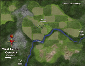
Ostrovia Regional Map:
This is the regional map created as part of the October 2007 Challenge Map at cartographersguild.com
Like the above map, this regional map was completely created within Xara Xtreme 3.2, with some 3D elements in the monastery depicted near the center of the map.
This was part of my October Challenge, although I didn't win, I came in a close second place with this entry.
|
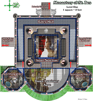 |
Monastery of St. Bes map:
This is actually the first floor of the primary map created for the October Challenge at cartographersguild.com. The previous regional map of Ostrovia, was a supplemental map, this structure map is the actual entry.
I created a second floor, a roof plan, and a cellar for this map. The regional map, above was also accompanied by a map of just the monastery environs - within the wall of the complex.
I featured experiments with mosaic tiles in this entry.
|
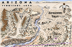 |
Superstition Valley map:
The November Challenge at cartographersguild.com was to create an "Old West" styled map, as well as required number of map objects that could be used to create custom old west maps in various mapping applications. I won with this entry!
This is completely hand-drawn, scanned and finished in Xara.
For this challenge, I created over 200 map objects. The mountains are actually "modules" of mountain parts allowing users to build their own mountain ranges.
|
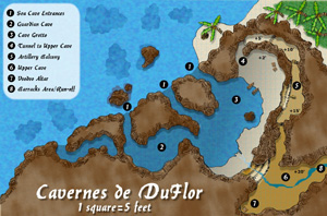 |
Cavernes de DuFlor map:
The December Challenge at cartographersguild.com was to create a cavern by the sea, with evidence of pirate activity.
This too is completely hand-drawn and finished in Xara Xtreme. For this entry, I include lots of additional content - a second map to complete the caverns, an island map where this cave is located, a village map on the island, and the basis for a complete adventure with illustrations.
I did not win with this map, but came in a close second place.
|
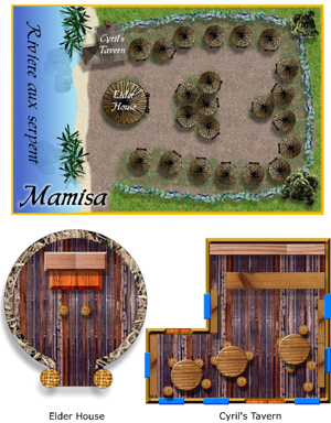 |
Village of Mamisa, Isle de DuFlor map:
This is the village map for Mamisa, part of the Cavernes de DuFlor entry.
Noting all the French name references - I am not French, nor do I speak it, I got help online from various members who are, and helped develope this aspect of my map.
The background story for the map involved an escaped, black slave girl from New Orleans, dressed as a boy and smuggled herself aboard a sailing vessel that was pirated and she joined that crew. Eventually becoming an infamous pirate herself.
I also developed a Voodoo background for the woman pirate, and this village on her islet. Mamisa is a voodoo priestess's title.
Of the French names - the island is called Roche de la Sorcier, the pirate is named Paulette DuFlor, with many other names on an island map provided as well.
|
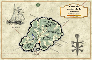 |
Roche de la sorcier map:
This was another supplemental map provided with the December challenge entry - Witch's Rock.
This is the regional or island map - you will notice location for Mamisa and the Cavernes de DuFlor.
The mountains were map object elements from my Superstition Valley map, repurposed for this entry. I also hand-drew the schooner from a photo for a map illustration.
|
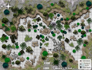 |
Valley of the Spider-Eaters map:
This one of the three commissioned maps for Doghouserulez publication QuickQuests: Eggsellent Opportunity. The art director had provided a pencil rough sketch of exactly where every tree, cliffside and encounter was supposed to go with appropriate scale requirements.
Although this map is in color, the actual commission required maps for use in a b/w printed product. So the art here reflects its eventual conversion to B/W - that's why the grass is grey.
|
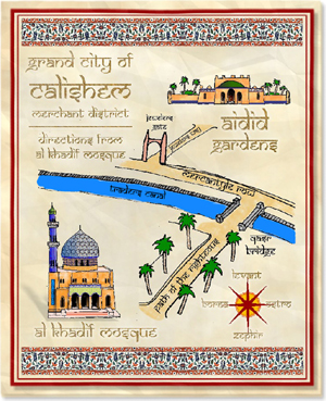 |
Party Invitation map:
The January Challenge at cartographersguild.com required entrants to a create an invitation to a merchant's lavish party, with directions to getting to his location from a major landmark.
This is my second challenge first place entry at the guild. The entry included an invitation cover and a letter of details, this page is the third page of this invitation hand-out and the map portion.
As you may be able to tell, when not given specific direction, I feel most inspired to dabble with various cultures and artistic styles pertaining to those cultures. I have seen few arabic flavored maps, and I enjoyed creating this one.
Rather than a true useable gaming map, this makes for a great hand-out for players.
Note the compass directions use name of Winds or Wind gods and the directions associated with them, based on historical references - this is before true compass directions existed...
|
 |
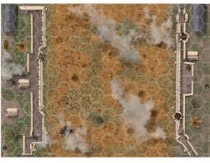
Printed map design for GDW's Blue Max:
This is my first locally commissioned map, that is someone in my hometown, who needed a map to be used at Rockcon - a gaming convention held in Rockford, Illinois for an event game.
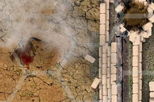
GDW: Blue Max is the game the event holder is presenting. He desired a WW1 trench warfare map, that the games airplane dogfighting occurs over. The map features trenches of the allies on one side, the Germans on the other. Note clouds overhead.
The lower map, is a close up of the detailing in this map, which has a very small scale, 3 inch hex = 50 feet on a 36" x 48" map.
Although not the publisher (shut down) the client was a gamer running an event at the con. He loved it!
|
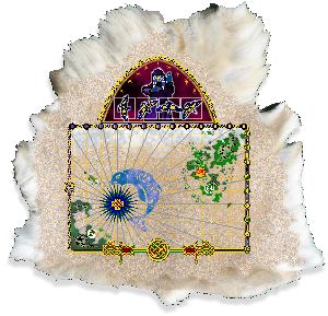 |
April Challenge, map with a secret:
This challenge, I perhaps got too extreme in culture. The challenge requirements were to create an ocean area map with the mainland and at least two islands on it. Additionally, a secret location was to be placed on the map, along with a riddle or some means of identifying that place.
I chose to create a map created by a pre-literate people, in this case Picts, for post-Ice Age campaign world I'm developing for a personal game. So their are no words or numbers to describe scale, locations, navigational tools, nor the riddle - which is in the top of the map. I also chose to map on a Dire Wolf's skin, rather than to paper.
This map was completely created in Xara Xtreme 3.2, with one image (wolf skin). The celtic knotwork was a font. This entry did not win the April Challenge, but it was fun all the same.
|
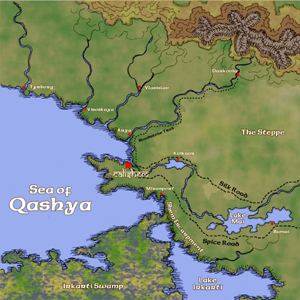 |
Regional Map for CWBP at the Guild:
Cartographersguild.com is working on a collaborative world building project (CWBP). Using Fractal Terrains to generate a random world map, a region within one particular continent was selected as a starting point and 30 square regions were gridded out for mapping. Volunteers select available regions to develope from region to city and site maps.
I selected this region near the heartland of the continent on an inland sea with a mongol hordes region.
You should notice Calishem is the regional capital here - same location I used in the January Challenge entry.
This map is hand-drawn, digitally scanned, colored and composited in Xara Xtreme 3.2
|
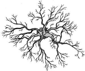 |
Base Tree for map object set:
This is my first base tree hand-drawing to be used to create my proposed adventure module, being created for use in MapTool VTT application. I plan to create about 20 maps, 200+ map objects and a complete D&D 4.0 adventure based in swamp forest, I call the Bogwood.
This is the first of ten or so hand-drawn, unleaved trees, that I will create for the map object set. I have versions in all four seasons with plans to create 9 more base trees, 6 bushes, rock piles, fallen logs, etc. The final objects will be 200 ppi at appropriate scales at 1" = 5'
|
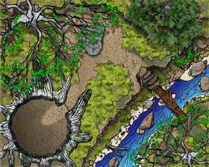 |
May Challenge Entry:
This is my May Challenge Entry - create a map scaled for VTT, at 50 ppi, and 1280 x 1024 (the image on the size is larger.) Anyway, a completely hand-drawn battlemap entry.
Previously most of my hand-drawn work applied to regional maps, this is one of the few at battlemap scale.
My VTT adventure project will feature all hand-drawn battle maps and map objects.
|
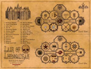 |
Contest Challenge Entry:
This is my Context Challenge Entry for dndadventure.com - create a map with at least 25 locations for use in a D&D game. I've never really created a structural map in my hand-drawn style, this is the first.
The map is of a citadel used by the Priestly Lich, Lhessadrak - featuring Nosferatu Nuns, a greater mummy craft master, both a giant skeleton and a squad of skeletal warriors provide the temple guard. All treasure rooms are trapped and are haunted by Shadow, Wraiths, Spectres or Ghosts.
Linked map is 1.85 MB file at 4000 pixels wide and 96 ppi
|
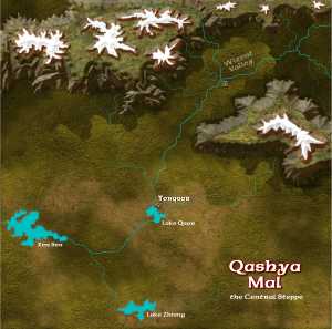 |
Regional Map for CWBP (Part 2):
I wanted to experiment with different types of mountains, using my recent upgrade to Xara Xtreme, version 4.0.
There is extensive use of beveling in the mountain objects, as well as use of "stain-glass" filter at 0% transparency - this works much like "multiplying layers" in a raster application. I did this both to soften some of the bevel details and apply an additional level of texturing.
This map is really still a work-in-progress.
I wanted to do something completely different than my hand-drawn map of the eastern reaches of Qashya Mal - as the CWBP is intentional built to be a mixture of mapping styles - I thought I do something different. Now I still have one more region to map, mmm.
|
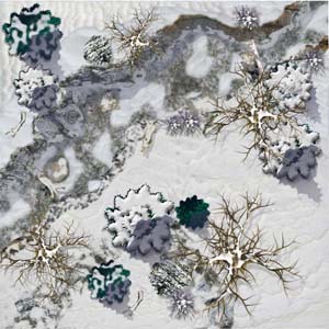 |
Winterscape Map for Virtual Tabletop use:
There seems to be a lack of winter/snowy/glacial/alpine RPG maps available on the market. After finding some excellent photo textures of snow and ice at CGTextures.com, I decided that I was ready to try my hand at a photorealistic styled winterscape map. So I created a series of 4 winterscape maps.
Although this map could be easily rescaled for printed use, the current scale and dimension has been optimized for use in VT applications like: MapTool, Fantasy Grounds or Battlegrounds. It seems the VT community prefers photorealistic styles for encounter scale maps.
Note: all map objects - snow covered trees, rocks and logs were equally unavailable online, so these are all my own creations. Often I used existing 3D models and PD Particle objects of my creation, enhanced with the snow features.
|
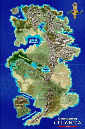 |
Continent of Celanta (Homebrew World):
Expanding the techniques learned in creating the Winterscape map above, I was compelled to try them for larger scale terrain. This is the primary style of map I create for private commissions by individual gamers for high quality map graphics, yet quickly created allowing on a lower commission payment.
The small continental map of Celanta to the left is based on this completely digitally created map using Xara Xtreme 4.0. I was able to create the map to left in about 8 hours, though the bulk was created in a little over 2 hours - with lots of tweaking until the details worked for me.
As a geologic anamoly, I created the surface remains of a comet strike - the crater lake at the center of the map, being a shallow strike, the land to the immediate northwest of the crater is a canyon created by the comet skimming the surface before careening with the mountain range beyond and ejecting most of the material up and offworld.
|
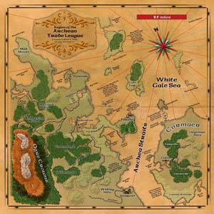 |
Regional Map of the Archean Trade League:
This was my September 2008 Mapping Challenge Winning Entry at Cartographers' Guild. There were 30 entries and the most voter participation in the history of the CG with over 100 votes.
The challenge was a given outline of the regional coastline and islands, generalized locations for the rivers, forest, hills and mountains given as necessary parameters - as if a map request from a potential publisher-client. "Following these parameters, create a map in your own style!"
I chose hand-drawn as a basis for all elements, but primarily in outline with minimal hand shading. Once the drawing was scanned and imported to Xara Xtreme for beveled shapes and color. Noteable features of the map include the hand-drawn town symbols of specific structures at each location, the choice of not using a "blue ocean" fill, and the textual notes placed throughout.
|
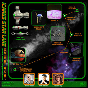 |
CG's November Challenge - Space Map:
This was my November 2008 Mapping Challenge Entry at Cartographers' Guild. At this time there is still a week or more away until voting begins. I decided to emphasize a potential Sci-Fi storyline in my entry. There is a featured star lane used by a covert smuggler scout vehicle called the Icarus. It has stolen secrets from the "Alliance Bureau of Naval Intelligence" and destined to trade this information with the Asahi Shogunate - a militant imperial Japanese starfaring nation in competition with the Alliance.
The map tells the story itself and resembles a 1970's sci-fi movie poster, a hand-out for a Traveller game, or as a startup screen for a space video game.
This is the very first time I have ever tried to create a fantasy map based in outer space! I think I did rather well.
|
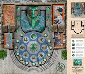 |
Sargoseum - the Temple of the Sea God
In November 2008, Iron Crown Enterprises announced their first map contest - Create a Temple Map. Four days after the announcement, I submitted this map as my entry.
It was almost completely created using Xara Xtreme, except for the 3D statues in the temple, which I used Nendo to generate the models and Raydream to render them. I converted to transparent PNG files then imported to Xara for final composition.
In a way, I think I scared off the competition. There is only one other entry, though I know of another mapper that is supposed to get one in before the deadline, which is January 1st, 2009. I am hopeful of a win with this entry, however.
|
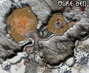 |
Ogre Den - a battlemap for my homebrew...
I am currently in the works of mapping my homebrew campaign, the Northlander Picts - a barbarian world for D&D. Although I've begun working on the regional maps now, as sort of doing the process backwards, I began this personal project by creating encounter scale maps first.
To the left is one of the many battlemaps so far, the Ogre Den. I'm using my familiar raster image fill on vector shapes using Xara Xtreme and stacking each in layers to build the final map. Although I cannot post here, I have recently completely a similar styled map for an upcoming Conan RPG adventure for Mongoose Publishing, in the UK.
|
 |
Feudal Japan Map Object set...
Being half Japanese, I've become aware that there is a lack of Japanese-esque art style in map objects for creating overland maps for Oriental Adventures, L5R and similar feudal Japan based games.
I have been referencing the Ukiyo-e (Japanese Wood Block Print) style of art, perfected by the masters: Hiroshige and Hokusai to create hand-drawn map objects of mountains, trees, structures and even people. Rather than differentiate a highway from a country road or walking path, I have opted to create map objects of people walking, on wagons, ahorse to place in roads in several directions to indicate which is which. Walkers for walking paths, ox driven wagons for country roads and mounted samurai for highways. Still a long way to go on this project, but it is fulfulling nonetheless.
I've offered this set idea to Profantasy as possible content for their Campaign Cartographer Annuals. Though they are still considering it. I have just begun a 300 symbol map object set for Profantasy, for their SS3 Modern Symbols set.
|
|


